
In the field of Precision Agriculture, the use of Drones (multicopter & fixed wing) gains more ground day by day, with the great benefits that they offer recognized by farmers all over the world.
It makes absolute sense, when a farmer realizes that they can fully supervise their farmlands and crops in only a few minutes.
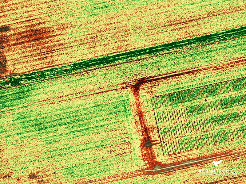
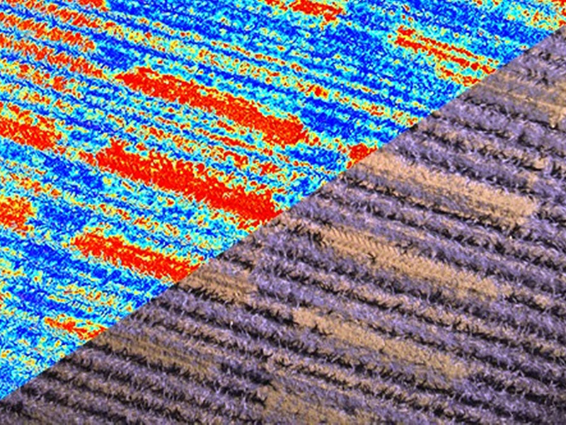
Appropriate RGB, Multispectral and Thermal cameras with Radiometric Measurement can collect images from the visible as well as the non-visible spectrum of human vision, and in different wavelengths of ultraviolet and infrared radiation.
The NIRS (Near Infrared Spectroscopy) is a measurement that concerns the electromagnetic spectrum in relation to the heat rate that ranges from 700nm-2500nm. This measurement is especially important in precision agriculture, since the plants absorb energy in the above-mentioned spectrum.
This means that the more energy is absorbed by the cultivated plant, the more healthy and resistant it becomes, by giving the farmer useful information about the estimation of the growth rate as well as the final volume of their crops.
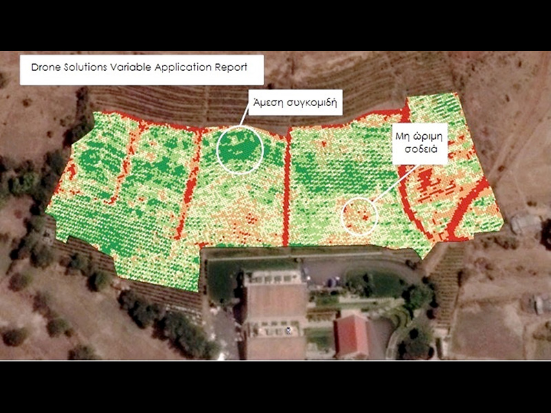
This, along with other specialized agricultural applications, such as the detection of illnesses, exact distribution of fertilizer, aerial sprayings, the counting of plants and their sufficient irrigation, constitute the most up-to-date methods of agricultural production, maximizing the yield of any farmland.
Potential Applications and Uses
- Plant Growth Monitoring
- NIRS Mapping
- Plant Counting
- Decease Detection
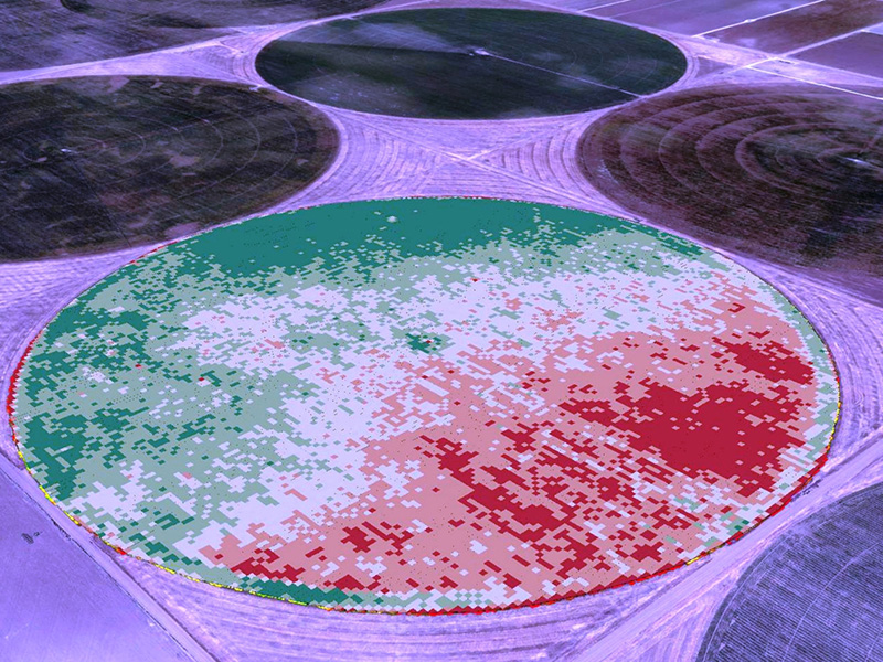
- Irrigation Mapping
- Harvest Priority Mapping
- Stockpile / Volume Calculation
- NDVI Map
- EVI Relative Map
- EVI Calibrated Map
- Infrared Map
- Water Stress Map
- Pure Canopy/Vigor Map
- OSAVI Map